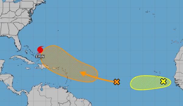
The National Hurricane Center continues to predict that Tropical Storm Erin will develop into a major hurricane as it continues to move westward across the Atlantic on Tuesday.
The center of Erin was moving west at 22 mph with maximum sustained winds of 45 mph as per the NHC’s 5 a.m. report, and it was situated roughly 1,890 miles east of the Caribbean’s northern Leeward Islands. There are 45 miles of tropical storm force winds.
According to NHC senior hurricane specialist Richard Pasch, this motion is anticipated to persist for the next few days with a slow decline in forward speed and a gradual shift toward the west-northwest. Erin is predicted to become a hurricane within the next few days after gradually intensifying over the following few days.
The fifth named storm of the 2025 Atlantic hurricane season, Tropical Storm Erin, forms in the eastern Atlantic Ocean close to the Cabo Verde islands.twitter.com/CaAqNs7oje as a picture
CIRA August 11, 2025 (@CIRA_CSU)
By early Thursday morning, it is expected to strengthen into a Category 1 hurricane, the season’s first hurricane with sustained winds of 75 mph, according to the NHC’s long-range projection.
According to Pasch, the official intensity projection indicates that Erin will become a major hurricane in around five days, which is at the upper range of the model guidance. Predictions of intensity at this time range are quite unclear.
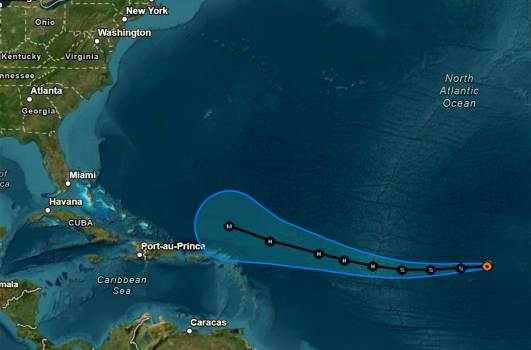
With a cone of uncertainty covering a large area in the Atlantic just northeast of the Leeward Islands, the prognosis indicates that it will develop into a significant Category 3 hurricane by early Sunday morning with sustained winds of 115 mph and gusts of 140 mph. Starting Friday evening, winds might be noticed in the islands.
This week, Hurricane Erin might form. These are some potential forecast tracks.
It’s too early to say whether Florida will be affected, according to Melbourne’s National Weather Service.
Peak hurricane season is about to begin. Forecasters advised using this time to make sure you are ready for any hazards.
Though patterns can alter, Monday’s computer modeling forecast tracks primarily show the storm heading north before posing a threat to the United States.
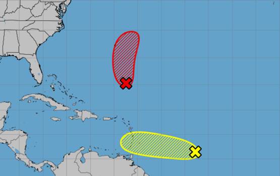
In addition, the NHC is monitoring a system in the Gulf and another Atlantic system.
The National Hurricane Center continues to predict that Tropical Storm Erin will develop into a major hurricane as it continues to move westward across the Atlantic on Tuesday.
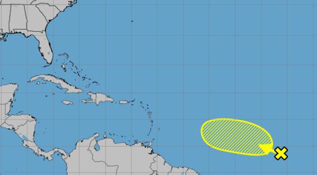
Forecasters warned of tropical rainfall over the Gulf coast, although the Atlantic systems had a 10% probability of developing and the Gulf system had a 0% chance as per the NHC’s 8 a.m. tropical outlook.
There was a wide region of haphazard showers and thunderstorms along the surface trough that was close to the Louisiana shore.
Although this system is not expected to develop before moving inland later today, forecasters warned that over the course of the next day or so, locally heavy rains might cause flash floods across parts of the northern Gulf coast.
A few hundred miles southeast of Nova Scotia, Canada, the residual system was a nontropical area of low pressure with erratic thunderstorm and shower activity.
Forecasters indicated that when the low meanders close to the comparatively warm waters of the Gulf Stream, some limited tropical or subtropical development may occur over the course of the next day or so. By Wednesday, the system’s chances of developing into a tropical storm are predicted to end as it moves northward over cooler seas.
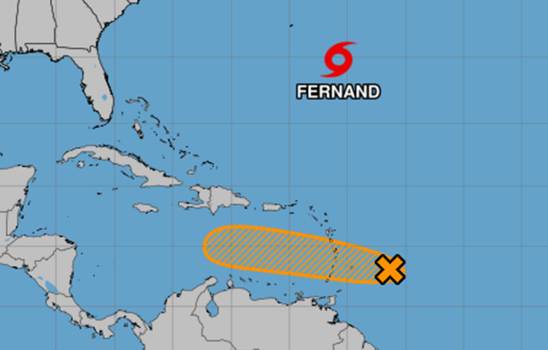
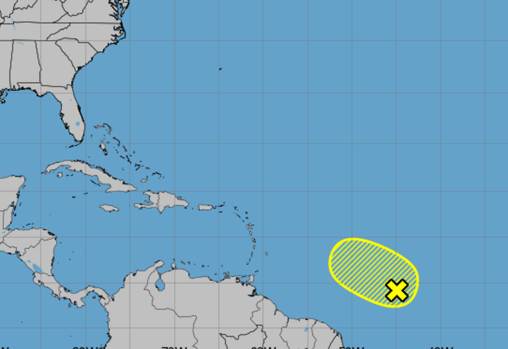
Fernand and Gabrielle would be the next names on the 2025 Atlantic hurricane season after Erin.
The National Oceanic and Atmospheric Administration revised its season estimate last week, predicting 13–18 named storms in total, with five to nine of those storms developing into hurricanes. Of those, two to five would grow into powerful hurricanes with a maximum intensity of Category 3.
Hurricane season lasts six months, from June 1 to November 30. It peaks from mid-August to October.