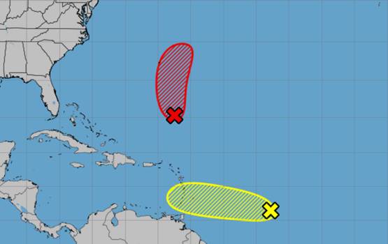
On Saturday, the National Hurricane Center kept an eye on two additional Atlantic systems that could develop into the next tropical depression or storm of the season.
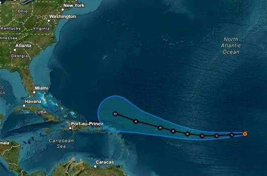
The most likely of those, according to the NHC’s tropical outlook for 8 a.m., was a low pressure system that developed roughly 500 miles southeast of Bermuda and had more organized thunderstorms and showers.
Forecasters predict that a tropical depression may emerge later today or tonight, and that when the low moves northward over the southwestern Atlantic, it will likely intensify further into a tropical storm on Sunday.
According to the NHC, anyone with an interest in Bermuda should keep an eye on the system, which will be investigated by an Air Force Reconnaissance aircraft in the afternoon.
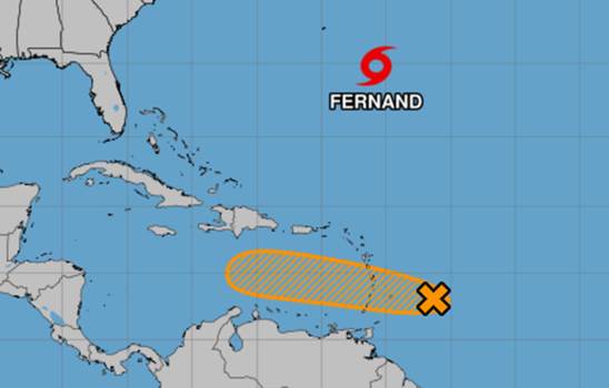
If strong enough, it might develop into Tropical Storm Fernand or Tropical Depression Six.
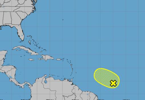
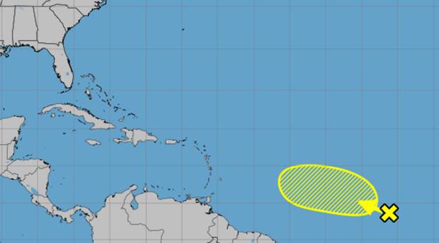
About 850 miles east of the Caribbean’s Windward Islands, the NHC also monitored a tropical wave that featured erratic thunderstorms and showers.
Over the next few days, as the system rapidly advances westward at a speed of around 20 mph, some development of this system may take place, according to forecasters. As the system passes through on Sunday and Monday, parts of the Windward Islands may experience strong gusts and locally heavy rainfall. Conditions across the central Caribbean are predicted to be unsuitable for additional construction by the middle of next week.
It had a 10% probability of developing within the next two days and a 20% chance within the next seven, according to the NHC.
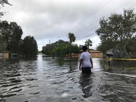
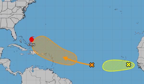
Hurricane Erin, the first hurricane of the season, became extratropical on Friday without making landfall, despite being responsible for nine fatalities in the Cape Verde Islands. Last week, it intensified into a Category 5 storm with gusts of 160 mph.
The Atlantic beaches are still at high risk of rip currents today due to the lingering surf from Erin. Observe local beach patrol flags and signage and always swim close to lifeguards.7kHThWhr2n #FLwxpic.twitter.com
August 23, 2025, NWS Miami (@NWSMiami).
As it swerved around the U.S. East Coast, it drove over the Atlantic and turned north, dumping rain on the Virgin Islands, Puerto Rico, the Turks & Caicos, the Bahamas, the Leeward Islands, and the Outer Banks of North Carolina.
On Saturday, the Atlantic coast is still at risk from storm-related waves.
According to a recent update to its season forecast, the National Oceanic and Atmospheric Administration predicts 13–18 named storms this year, with five to nine of those storms developing into hurricanes. Of those, two to five would grow into powerful hurricanes with a maximum intensity of Category 3.
Hurricane season lasts six months, from June 1 to November 30. It peaks from mid-August to October.