ORLANDO, FL.Florida will still be affected by Hurricane Erin, even if it is predicted to remain far off the state’s coast this week and continue its journey across the open Atlantic.
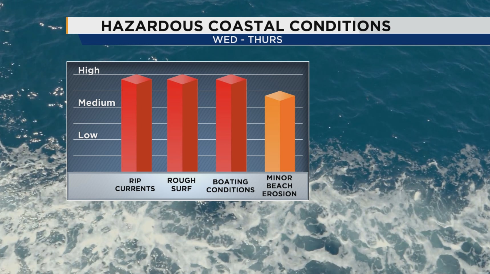
By Tuesday, harsh coastal conditions will begin to deteriorate throughout our east coast, with the worst of them occurring on Wednesday and Thursday.
Expect rough surf and a high chance of dangerous rip currents, which will be at their strongest in the middle of the week, starting Monday. Erin’s increasing waves will provide a number of risks to both boats and beachgoers.
[MORE: Hurricane Erin is predicted to cause rough waves on Florida’s east coast this week.]
All east coast beaches will be affected by high rip current threats beginning Monday and continuing throughout the week.
Additionally, the waves will be severe, peaking Tuesday night through Thursday and possibly reaching 5 to 8 feet. With higher tides, they may also cause some erosion of the beach and dune.
Boaters should exercise caution, especially when close inlets. Through Thursday, dangerous conditions might be created by seas that are 6 to 8 feet near shore and 9 to 11 feet offshore. Whether you’re on the water or at the beach, stay safe!
See Our Email Newsletter for More Stories Like This One