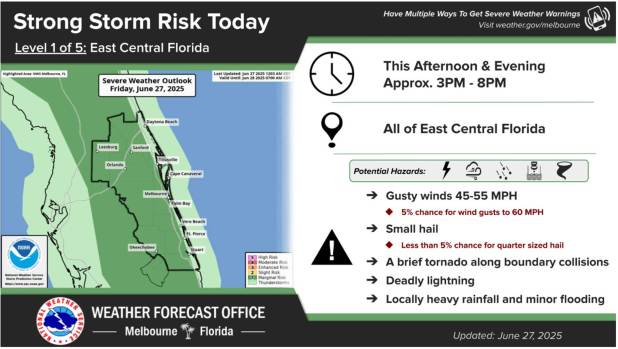
The National Weather Service said Friday afternoon and evening could bring hazardous thunderstorms to central Florida.
The NWS was warned of the possibility of lightning, heavy rains, and storms with a slight risk of gusts of up to 60 mph, hail as large as a quarter, and even a brief tornado.
This is accompanied by persistently hot and muggy weather with heat indices that may reach between 100 and 105 degrees Fahrenheit.
The typical inland east coast sea wind will not move into Central Florida until late in the afternoon due to a weather pattern originating from the Florida panhandle. When it does, there is a 60–70% probability of precipitation, which could result in 1-3 inches of rain in some places.
Forecasters warned that convection might persist until about ten o’clock at night before waning. The rest of the nighttime hours are then predicted to be drier.
While severe weather is less likely, weekend wind patterns will continue to increase the likelihood of afternoon and evening showers. However, the area that has had drought conditions this year may gain from rainfall.
With highs in the lower 90s, the heat is still present. Peak heat indices of 100 to 105 will result from more humid circumstances, according to experts.