ORLANDO, Fla.
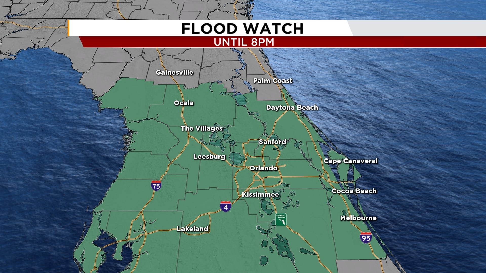
– East Central Florida is under a flood watch until 8 p.m. Tuesday, as conditions continue to be concerning for localized flooding with rainfall rates picking up to 3-4 inches per hour.
Over the past couple of days, several rounds of tropical downpours have soaked the region, with 5 to 7 inches of rain falling in some areas, particularly across southern Brevard and northern Volusia County. On Tuesday, conditions continue to be concerning for localized flooding, with rainfall rates increasing in Central Brevard County.
This has already triggered multiple advisories, and more rain is expected through the evening.
[VIDEO: Heavy rain causes flooding in Edgewater neighborhood]
The flood watch covers a wide area, including coastal and inland Volusia, Brevard (inland, mainland, and barrier islands), northern Lake, southern Lake, Orange, Osceola, and Seminole counties.
With the ground saturated, any additional rainfall could lead to flooding of rivers, creeks, streams, and urban areas with poor drainage. Smaller waterways could rise out of their banks, and flash flooding in low-lying areas is a possibility.
This ongoing rainfall and flood risk are being driven by a broad area of low pressure in the eastern Gulf of Mexico, known as
Invest 93L
.
While this system remains disorganized, it’s continuing to feed moisture into Florida and could develop further as it moves into the central Gulf later this week.