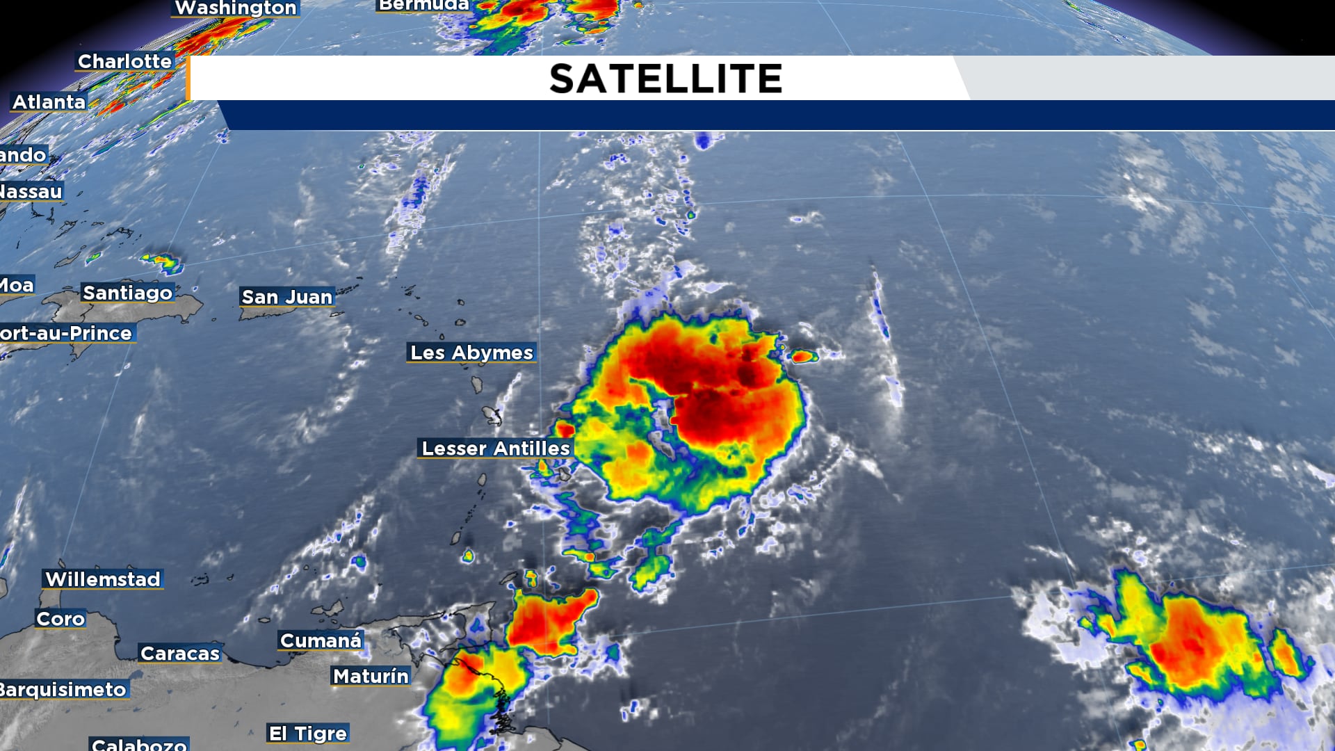
ORLANDO, FL.According to the National Hurricane Center’s 8 a.m. forecast, Invest 99L is exhibiting improved organization as the number of showers and thunderstorms increases.
As it moves westward into the Leeward Islands, it has the potential to develop into a tropical depression within the next day or two, even if it does not yet have a closed surface circulation.
By Tuesday, this tropical wave is predicted to make its way into the central Caribbean. Early this week, forecast models are generally in agreement on that course, but there are declines in confidence on the center’s potential trajectory after that.
Gabrielle is the next name on the list in the event that it becomes a named storm.
[EXCLUSIVE: Sign up for a free News 6 Insider account| PINIT! Post your images]
Over the open Atlantic, Tropical Storm Fernand formed yesterday afternoon. According to the most recent projection, there won’t be any land consequences and it will remain over ocean and relatively weak.
Central Florida does not now face any tropical problems.
[LATEST FORECAST: Central Florida may see heavy rain in patches]