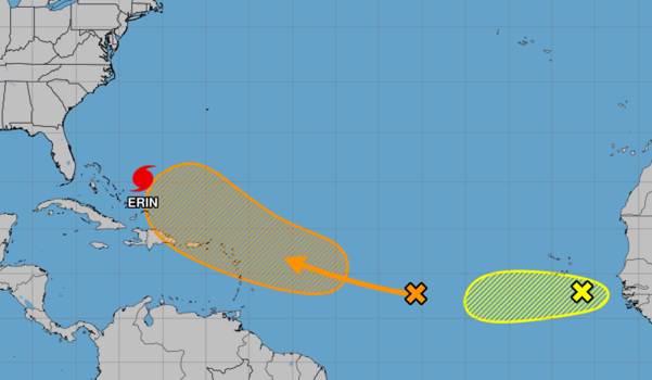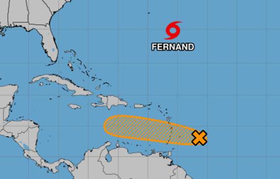
In addition to monitoring a system that is headed toward the Caribbean and has the potential to develop into the next tropical depression or storm, the National Hurricane Center on Sunday kept tabs on the recently formed Tropical Storm Fernand in the open Atlantic.
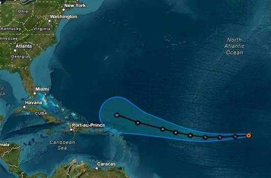
About 300 miles southeast of Bermuda, the center of Fernand was traveling north-northeast at 15 mph with maximum sustained winds of 40 mph as per the NHC’s 5 a.m. advisory. Winds of tropical storm force stretch 105 miles.
According to forecasters, this motion is anticipated to continue for the next day or two before turning northeast. Fernand is predicted to traverse the open waters of the subtropical North Atlantic and move far east of Bermuda.
Although it might get stronger over the next two days, it is not anticipated to pose a threat to any land before waning on Tuesday.
While the NHC continues to monitor what may be the seventh storm further south in the Atlantic, Fernand became the sixth named storm of the 2025 Atlantic hurricane season on Saturday.
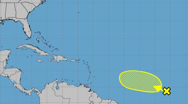
8 p.m. A tropical wave with a medium risk of developing over the next few days is being monitored by EDT NHC. On Sunday and Monday, this system is expected to deliver strong gusts and a lot of rain to the Leeward and Windward Islands. For more information, go to https://t.co/tW4KeGe9uJ.Twitter: pic.twitter.com/9SZfUgUuiT
August 23, 2025, National Hurricane Center (@NHC_Atlantic)
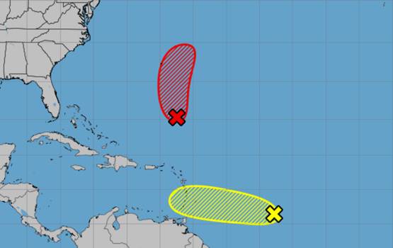
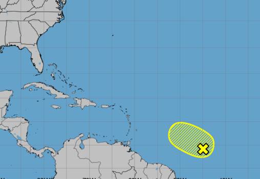
About 200 miles east of the Windward Islands, the tropical wave was accompanied by showers and thunderstorms but lacked circulation, according to the NHC’s 8 a.m. tropical outlook.
Forecasters warned that this storm, which is moving swiftly westward at 20 to 25 mph and would pass across the Windward and Leeward Islands later today and early Monday, might yet develop into a tropical depression over the course of the next day or two.
If it gets strong enough, it might be called Tropical Storm Gabrielle or Tropical Depression Seven.
Regardless of the outcome, the Caribbean islands should anticipate strong gusts and a lot of rain through Monday. On Tuesday, it is expected to move into the Central Caribbean, where circumstances are less conducive to further growth.
Later Sunday, an Air Force reconnaissance plane will examine the system.
It had a 40% chance of developing within the following two to seven days, according to the NHC.
According to a recent update to its season forecast, the National Oceanic and Atmospheric Administration predicts 13–18 named storms this year, with five to nine of those storms developing into hurricanes. Of those, two to five would grow into Category 3 or stronger hurricanes.
Hurricane season lasts six months, from June 1 to November 30. It peaks from mid-August to October.