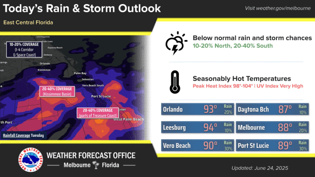
Although Tuesday is hot and muggy, there is a greater likelihood of storms during the week.
NWS Melbourne reports that daytime highs are in the low 90s inland and the upper 80s at the coast.
98°F to 104°F is the range of peak heat indices.
Throughout the week, east Central Florida will see a minor to moderate HeatRisk due to the temperature.
All of the local beaches are at a moderate danger of rip currents.
According to NWS Melbourne, disturbances are moving west and across Florida, which might increase the likelihood of rain and storms starting on Wednesday.
Lightning storms and sporadic or frequent daily rains are predicted to resume as a result of the disturbances.
There may be a few severe storms as well.